|
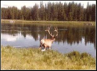
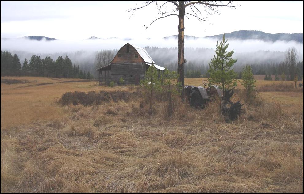
Stillwater River to cross here The fields, neighbors land & River Bottom |

|
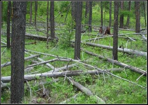
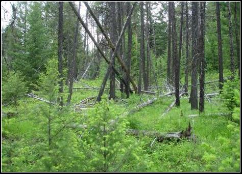
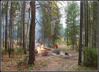
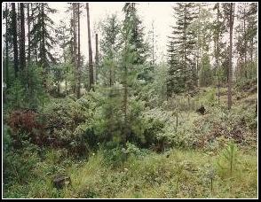
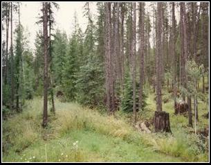
Timber is several feet from the highway notice it thru the trees center pictures. |
|
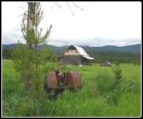
Land farther up the hill kept clean, probably not a good thing? pictured far right is planted wind rows for wild life to pass through so they can get to the river and onward into the wilderness. |
|
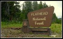
Above is the 960 acres of land, its Flathead National Forest. We want to save this brushy forest to protect the natural migration and bedding areas. The brush detours most hunters. The 960 acres are surrounded with suburban sprawl, logging, sportsman, bikers, hunters, farms, or ranches. We need to work something out with the department of agriculture, state of Montana, highway department, state and federal wildlife agencies at the same time were concerned with Forests from fire. We could allow fire road easement through our lands from highway into this if we can work together. |
|
Page 5 |

|
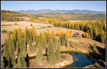
Our place |

|
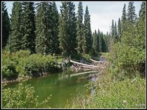
Crossing Area |
|
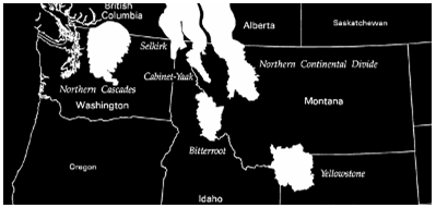
Salish Mountains and Flathead National Forest |
|
National Forests |
|
Red spot is us on the Grizzly bear recovery map |
|
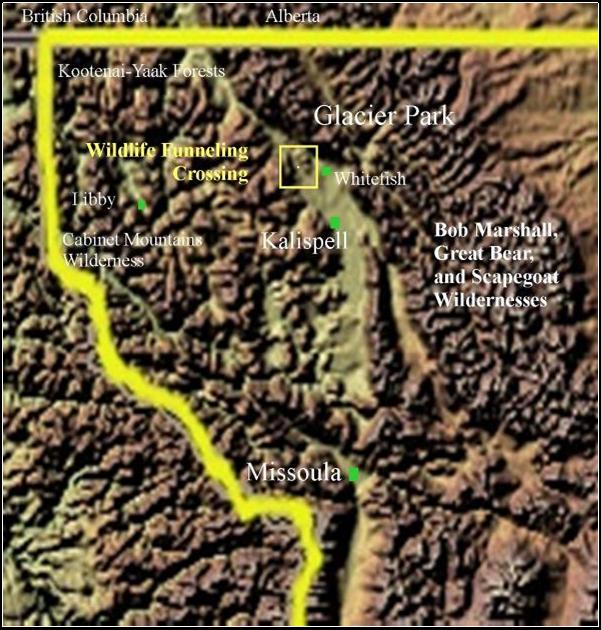
Looking west to Salish Mountains and Flathead National Forest. Montana's deepest natural lake is behind that far mountain 4 miles away Tally Lake, and beyond is Flathead — Kootenai and the Yaak forests. Glacier Park is 15 air miles from this position . |

|
93 |

|
logged |

|
logging |
|
wintering area |
|
us |

|
City limits |

|
This Grizzly recovery map we used, we are in or on the edge of all major Forests, wildlife habit, we are located in the last wild places in the lower 48, and we are in a funneling, migration route...and we are in the most valued scenic, living bedroom community, recreation, sportsman paradise in the US. And no end in site for the land pimps selling off the wide open places. |
|
here land all subdivided and logged |
|
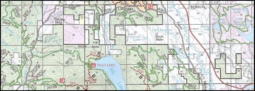
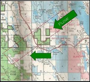
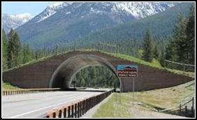
Right is Map I’m trying to show the mountains and then south to Missoula is valley of suburbia that directs the funneling of the wildlife north . to this narrowing of mountains , mostly timbered, at the north end of the Flathead Valley. From this yellow bow-spot (our corridor) Missoula is near 120 miles south, there is an animal bridge in a heavy populated Missoula area. The rest of the valley in Homes, Ranches, hobby farms, industrial and tourist attractions, crisscrossed with roads, avenues, streets highways and many county roads.
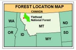
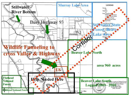
Below is Map Flatheads 960 acres Green , Blue is Montana State Forest, White Private, West is Tally Lake
|
|
. |
|
. |
|
. |
|
This is the highway crossing...if they get to here from the Beaver Lake Hills they are at the Stillwater River and them Foothills are Salish Mountains...This is why they use this narrow mountainous timbered canopy migration route. |
|
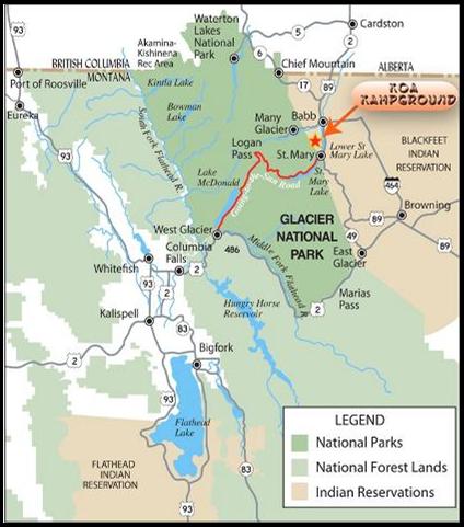
Proposing a US 93 Highway Salish Mountain Wildlife Corridor
|
|
Its being development on all sides now what's not being logged has homes, cabins, shops and business surrounding. this all natural 960 acres where the wild life is pushed in tight now . Maybe it’s the feed surrounding the parked out private lands and fields. But they cross this particular land then highway 93 to water and feed, nightly many are being killed. |
|
2008 |
|
1988 and highway 93 our land |
|
Whitefish Montana Wildlife |
|
ABOVE and left: At the head of Flathead Valley– North Missoula– Reservation, open year round to hunting I heard! .. we have the wildlife migration trying to do what they do Now….Ad the two long dams, Libby and Hungry Horse mile to go around Non avoiding noisy, deadly major highway to Glacier Part Entrance. With several towns Now funneled to east of Whitefish lake pushes them north still into upper Whitefish Upper Whitefish is only route westerly from Glacier park, Canada –Libby dam north is busy. Beaver lake north end of Whitefish Lake … Westwards is the Stillwater river drainage And Salish Mountains first highway 93 needs crossing .. And its deadly day and night. Wildlife need a break. Rick Hubble 2026
|
|
State Forest |
|
Alberta and British Columbia are north and Glacier National Park about 15 miles to the east. Were in the major part of Kootenai and the Flathead National Forests and near Montana's Wilderness. Idaho is 75 miles West. Wild life, deer, elk, moose, grizzly, wolves and lions all cross this highway and Stillwater River to get westerly on their migration from Northwest Montana. We are the closest forested land against the highway. We removed the fences for wildlife, it makes it safety as they dart across highway 93 on the fly into the Flathead National Forest. I think since the wolves have become so numerous the deer and elk have moved close into the residents / low lands to avoid them . I have never seen this many Deer, Elk, Moose, Bear, and Cougar in this area in my life. I haven't seen a Wolf or Grizz here but my sister & neighbors , Bordar have, since the 60’s, I seen two eagles...today I can count 7 a day here, at this place? |
|
what we may need? |